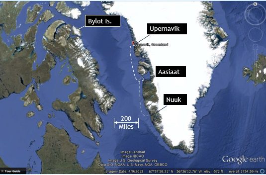
Middle of Baffin Bay
1930 EDT Saturday July 26, 2014 (72o 54’N, 65o 55’W): Middle of Baffin Bay
Thursday morning, Dave woke me from a deep slumber with 15 minutes to spare before my 0600 watch. Half awake, I mechanically swung my feet around the aft end of the lee cloth, onto the cold wooden floor. (The lee cloth is a heavy fabric shroud attached to the side of the bunk to prevent me from rolling out.) Having slept in my clothes, I only needed to put on my shoes before finding my way forward to the head. The cabin is headed, but to conserve fuel, the temperature is maintained at between 45 and 50 degrees Fahrenheit. The head is even colder, as we keep it isolated from the rest of the boat. The water temperature below is near 40 degrees. Still groggy, cold, and working hard not to miss the toilet with the pitch of the boat, it struck me that it makes no sense to waste time, effort and money on something as irrelevant and uncomfortable as sailing the north-west passage. Without any humor, I asked myself the question, “why am I doing this?” After making myself a cup of coffee and adding several layers of insulation, I headed up through the hatch to relieve Dave. With a weak attempt at humor, I asked, “why are we doing this?” Cheerfully he replied, “I don’t know,” and then proceeded to give me a situation report.
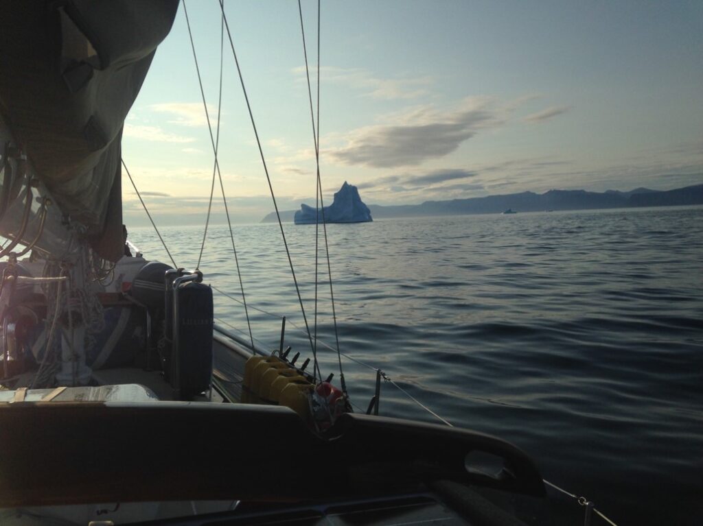
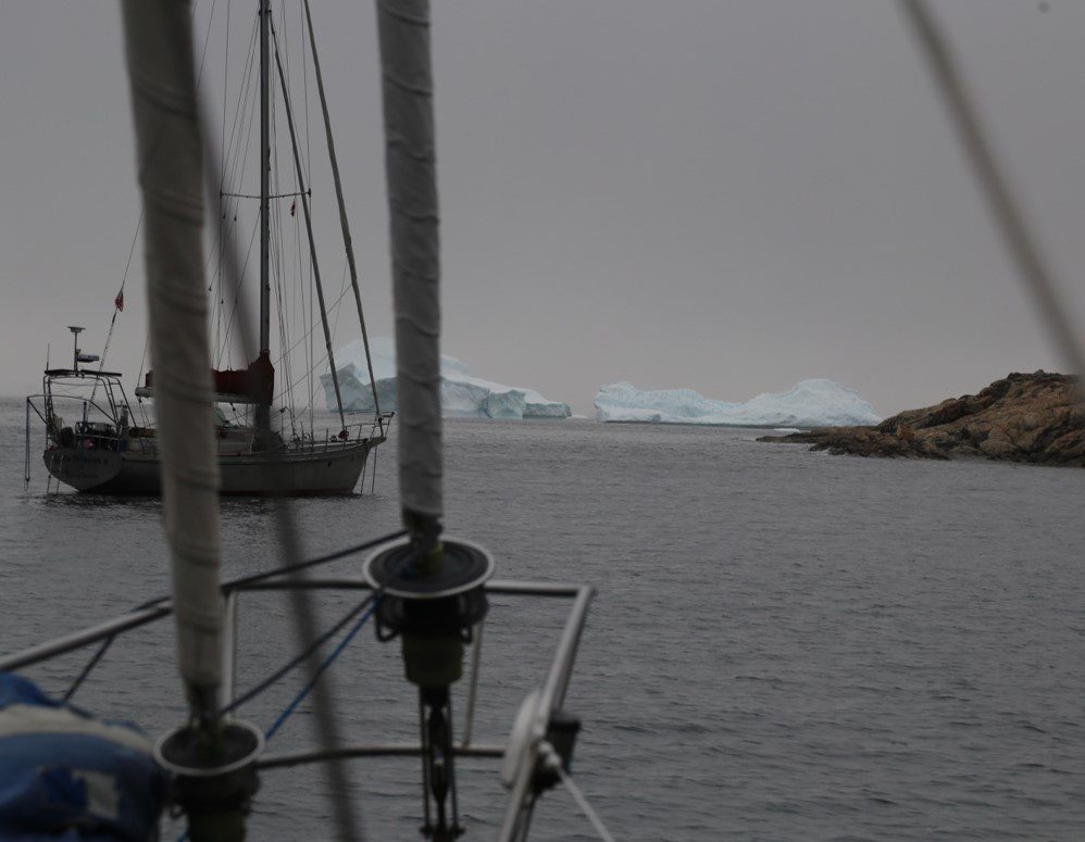
The situation was that we were motoring in a deep fog, with icebergs, but we were only about 20 miles from our next planned destination of Upernavik. The ice was a concern, as always, but we’ve learned to track the larger ones via radar, and keep a continuous watch forward for small ones. Of more concern was the fact that we were about to go off the charts. Not having planned to head this far north along the Greenland coast, our northern most chart with sufficient coastal detail ends eight miles south of Upernavik. While we had charts for the harbor itself, we did not have them for the approach. Given the situation, we had decide to stay well off the coast until at the same latitude as Upernavik and then head due east at reduced speed, using the forward looking sonar (FLS) to sound for any underwater obstructions. The FLS provides a map of the depths straight ahead, out to several boat lengths. In the process of heading in, the fog thinned and visibility improved to a mile or more. With the help of the FLS, and impressed by the thought that early explorers did not have the luxury of such modern electronics, we were able to find our way safely to the entrance to Upernavik harbor at around 1100 EDT, (1300 local).
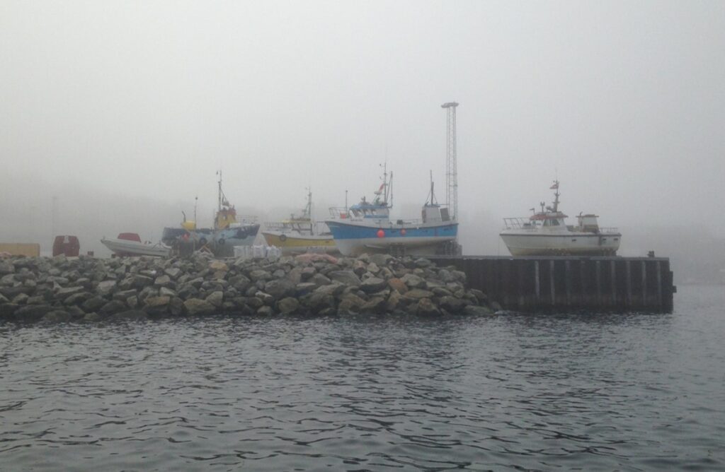
As we approached, Pete noted several sailboat masts off to the south side of the harbor, behind the prerequisite stand of Polar Oil tanks. As we entered the harbor, the outermost boat, flying a French flag, was putting out fenders for us to join. As in Nuuk, we were greeted with yacht-critical information about where and how to resupply and where to find showers and laundry. Within the hour, we were topped off with 200 liters of fuel at a cost of 1350 Danish Kroners (for those interested in the price of Diesel in Greenland). Since the supply ship was scheduled to arrive at the same dock later that afternoon, all headed out for their various destinations, which for us was the anchorage on the other side of the harbor.
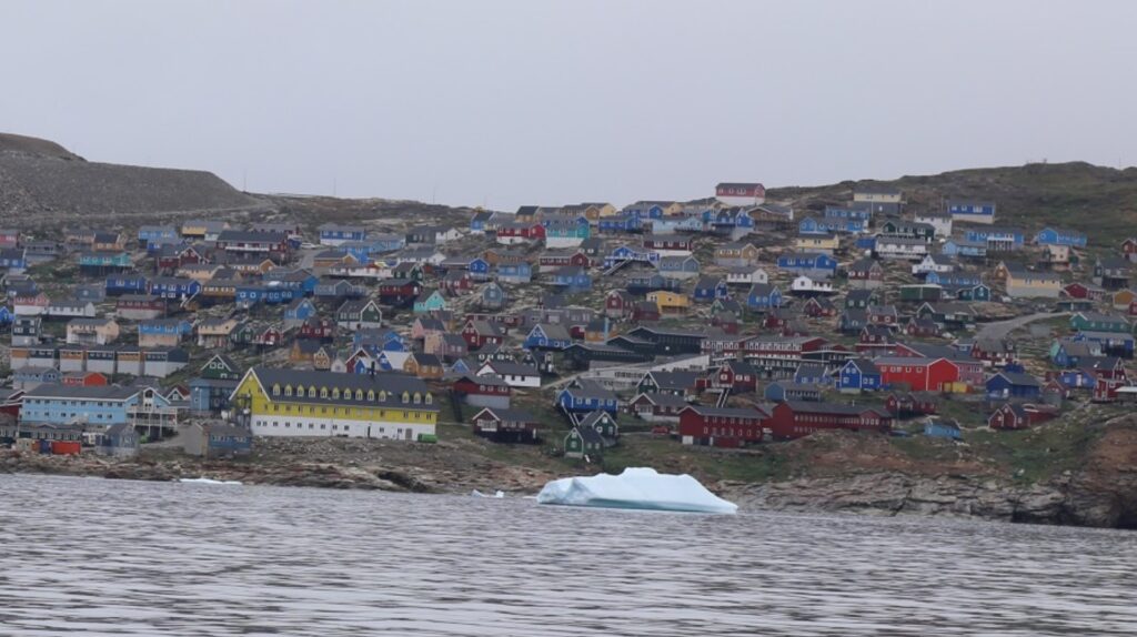
Upernavik is little houses, on the hillside, clustered above the harbor. The houses are simple, painted in solid primary colors, uniformly pre-fab, with three to four basic designs. They are connected by switch-back roads of packed dirt and wooden staircases. The power lines crisscross each other over the top of the rocks encased in rusted 2 ½ inch conduits. Chained next to their houses are dogs, so camouflaged and still, that we would point them out in surprise. Discarded items sit in the yards and line the roads. Cut into the hillside is a large recreational center with sports figures stenciled on the side, fronted by a rocky soccer field. And at the top of the hill is an airfield that must have cost nearly as much as the town to construct using large rocks to create a flat landing strip on top of mountainous terrain. Down at the harbor, several fishing boats sit in dry dock on the pier, supported at various angles braced by wooden pallets. Overall, Upernavik seems like it would be a difficult place to live, however, despite its somber appearance, it has an appeal. The surrounding fiords are magnificent. The people we dealt with were friendly and helpful. The children were inquisitive. In the evening, teenagers were playing soccer in front of the recreation center. And later in the evening, a crowd gathered near the shore watch a fireworks display shot up into the fog, under the mid-night sun.
We left Upernavik the next morning following our arrival, again in fog, following our traces, back out to deep water. Our current destination is Pond Inlet, Canada. Heading west feels like heading towards home. This afternoon, having settled in for a three day crossing of Baffin Bay, my watch was a pleasure. The wind was strong and steady. The direction was from the southwest, ideal for following a great circle route to our destination. (At this latitude, it is the shorter distance to circle slightly north, in order to go due west.) The boat was moving smoothly through the water, under control of the mechanical autopilot with its magical configuration of pulleys, lines, and foils. The sky was cloudy, and the air cold, but the visibility good, with the occasional iceberg showing off in the distance. I still don’t have an answer as to why we are doing this, except for the experience of the new places we have visited and a fresh perspective on things already familiar.