Icebergs, Whales and Fuel
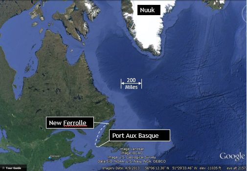
Wednesday, July 9th 1400 EST (51o 45’N, 55o50’W): In the Strait of Belle Isle
The wind is light and the seas calm, with fog that obscures the horizon and occasionally reduces visibility to less than 100 yards. Given the lack of wind, we are motoring through the Strait of Belle Isle separating the northern tip of Newfoundland from Labrador. Last night we anchored in the wide harbor of Port New Ferolle on the Newfoundland coast and then started moving again at first light. In anticipation of the ice field, the watch schedule has been changed to two-man shifts with 3 on /3 off /6 on /6 off/ 3 on /3 off. This will provide a second set of eyes for observation, especially during the hours of darkness.
Heading out this morning, we passed numerous small fishing boats, each which first shows up as a small arc on the radar and then, if close enough, materializes briefly into view before receding back into the fog. As we watched for boats and ice, a whale unexpectedly surfaced immediately to port, traveling in a direction as if he had just crossed under our path. Around 30 feet in length, it surfaced close enough to the boat that Dave was able to capture only a portion of it in the frame of his camera. Judging from the nicks and scars along its back and tail fin, it is a whale which has been around for a while.
And, as of this afternoon, we have seen our first iceberg. Peter first sighted it one mile off the port bow. Out of pure curiosity and for the purpose of testing our various detection systems, we headed straight towards it. The forward looking infrared system (FLIR) was encouragingly revealing, showing the iceberg in visible contrast to the warmer water and horizon. The RADAR also produced a strong signal, as would be expected for an object of this size. However, the Forward Looking Sonar (FLS) used to measure depths in front of the boat was less useful, in part because its range is limited to 600 ft and we were hesitant to approach mush closer than that, not knowing the shape of the ice beneath the surface.
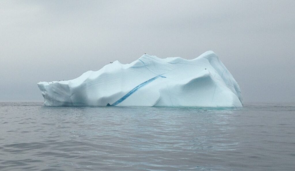
As for the iceberg itself, it was astonishingly beautiful. Above the surface, it was as tall as our sixty foot mast and as wide as at least three of our boat lengths. Even with no direct sunlight, the surface was a gleaming alabaster white, with the exception of veins of dense cobalt blue ice running through it, creating patterns similar to the way mineral deposits create marbled stones, such as the ones you find on the shores of Maine.
The only negative note of the day is our concern over fuel. If the tank gauge is accurate, we have consumed 3/16 of the 110 gallon tank in only 9 hours of running at 1500 rpm. That equates to a fuel consumption of 2.3 gallons per hour, or a mileage of only 2.6 km per gallon (assuming an average speed of 6 knots). If accurate, that is nearly double the expected consumption rate, in which case, we will empty the remaining 9/16 in our main tanks within 160 km. While we have approximately 40 gallons of extra fuel on board, that would provide only an extra 100 miles. Nuuk is 744 miles to the Northeast. Given that, we are looking for a harbor on the coast of Labrador to refuel before jumping off across Davis Strait.